 About us


A07-RTK rover
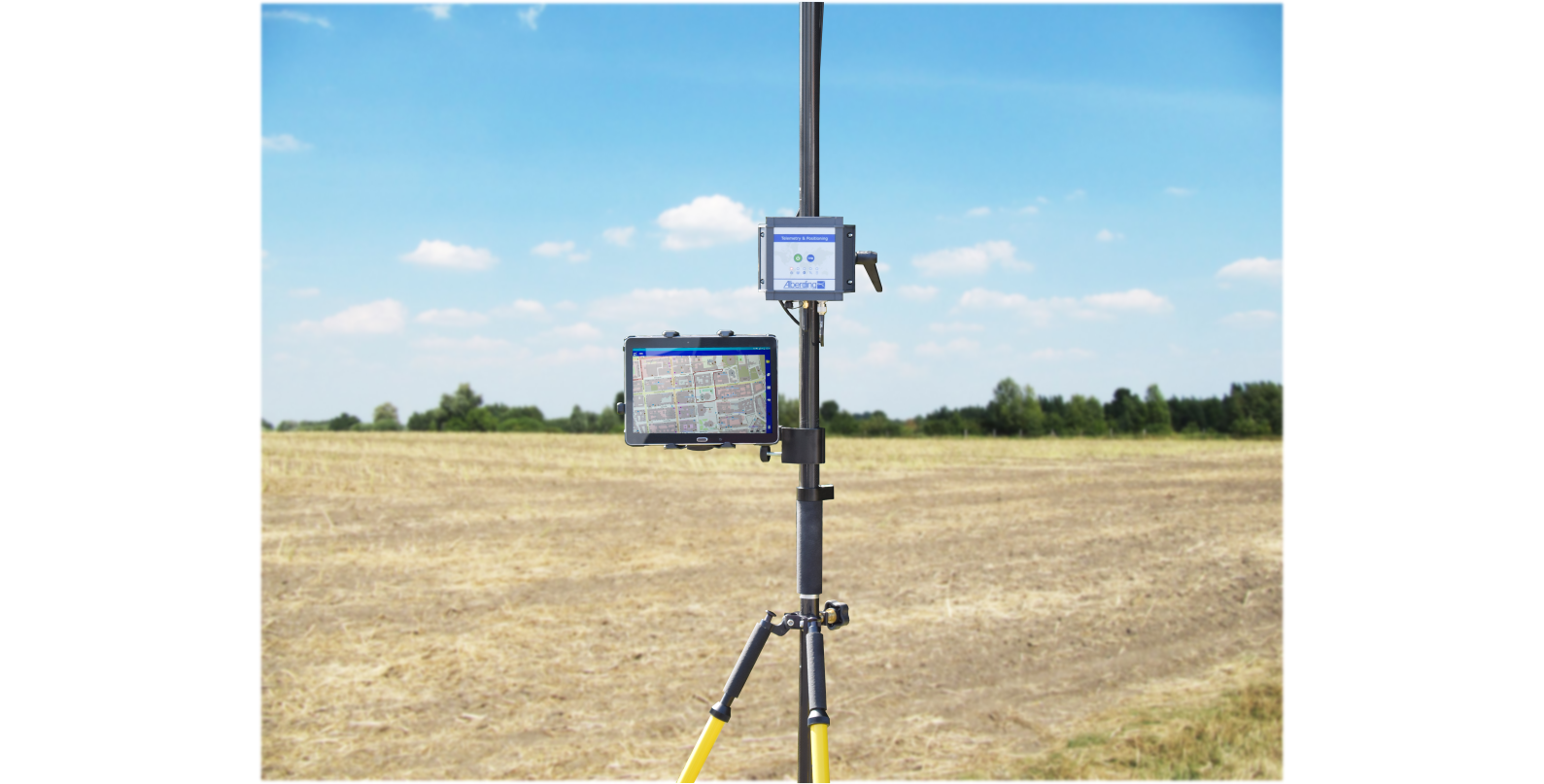
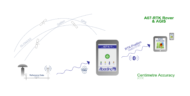
The Alberding A07-RTK is a powerful and cost-effective L1 GNSS multi-constellation receiver for sub-decimetre accurate real-time positioning and wireless data transfer. Together with the Alberding AGIS Mapping Software it provides a complete solution to surveying and GIS professionals for high accuracy field data collection.
The Alberding DGNSS processing along with the filter algorithms take raw GNSS observation data to compute a highly accurate position solution in real time. Position information can then be transmitted via Bluetooth to custom specific applications running e.g. on smartphones or tablets, via GPRS to a server (see: Alberding GNSS Data Management (Ntrip)) or can be logged on the internal SD card.
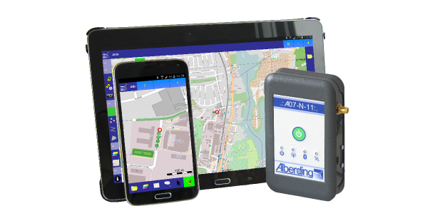
The Alberding AGIS mapping software is a professional and user-friendly software with wide-ranging GIS functionalities. It runs on any Android platform (e.g. on your existing smartphone or tablet), therefore there is no need to purchase an expensive, dedicated receiver controller hardware. It stores position data in ESRI shapefiles as points, polylines or polygons. Additional information (e.g. area, length and GNSS quality information) is represented and stored in attribute tables. With the functions Navigate and Tools it is possible to stake out, recover and correct existing points. Existing GIS data (shapefiles) can be imported for this purpose.
Further information: