 About us


Alberding Monitoring Software (AMoS)
Alberding GmbH has been developing and operating monitoring systems for a wide range of applications for many years. By using own hardware solutions customer specific requirements can be considered. The use of flexible web servers (Cloud) enables a fully automated data flow and a low-maintenance system operation.
The Alberding Monitoring Software (AMoS) is used for the continuous monitoring of objects (structures,
earth's surface). As input data, GNSS observations (RTK and Postprocessing) as well as measurement data
from tachymeters, inclinometers and geotechnical sensors are supported. GNSS raw data are automatically
converted into RINEX files and transferred to post-processing software. The processing results are
differences in coordinates relative to a GNSS reference station or absolute coordinates (PPP processing).
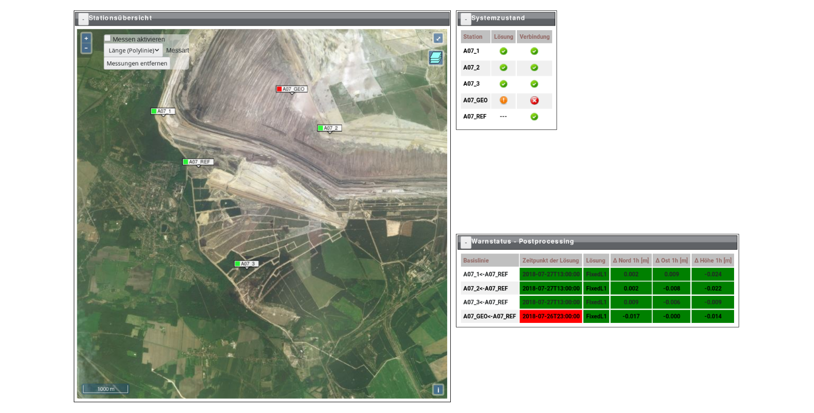
The Alberding GmbH's monitoring solutions are covering following core areas:
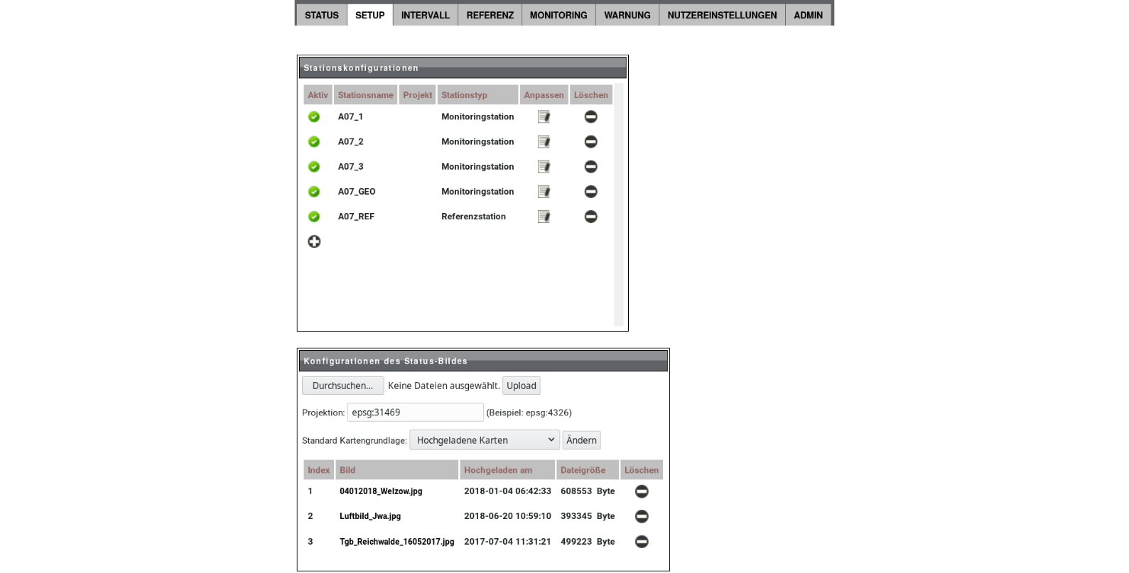
- Flexibly integrable and self-sufficient monitoring stations.
- Deformation monitoring.
- System status monitoring.
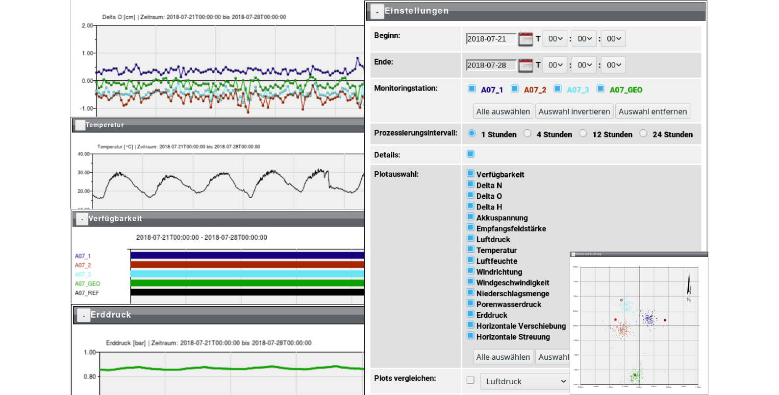
- Various evaluation methods (RTK, near real-time Postprocessing ...).
- Visualization via a password-protected web interface.
- Support of binary raw data of many GNSS hardware manufacturers.
- Support for standardized data formats such as RTCM, RINEX and NMEA.
- Alerting via SMS / E-mail when configurable thresholds are exceeded.
- Export of graphics and data as PDF or CSV.
- Monitoring of additional information (weather, inclination, ...)
- Interactive map with potential integration of own orthophotos.