About us


")
")
")


GNSS infrastructure (AtoN)
Software and system solutions for the operation of land-based services for inland navigation and maritime applications are one of the focal points of our developments. The products for the central generation, validation and coding of DGNSS correction data and for the distribution of up-to-date information about the inland waterways are adapted to the requirements of the Aids-to-Navigation Service Provider (AtoN) and are further developed in research projects (e.g. SCIPPPER).
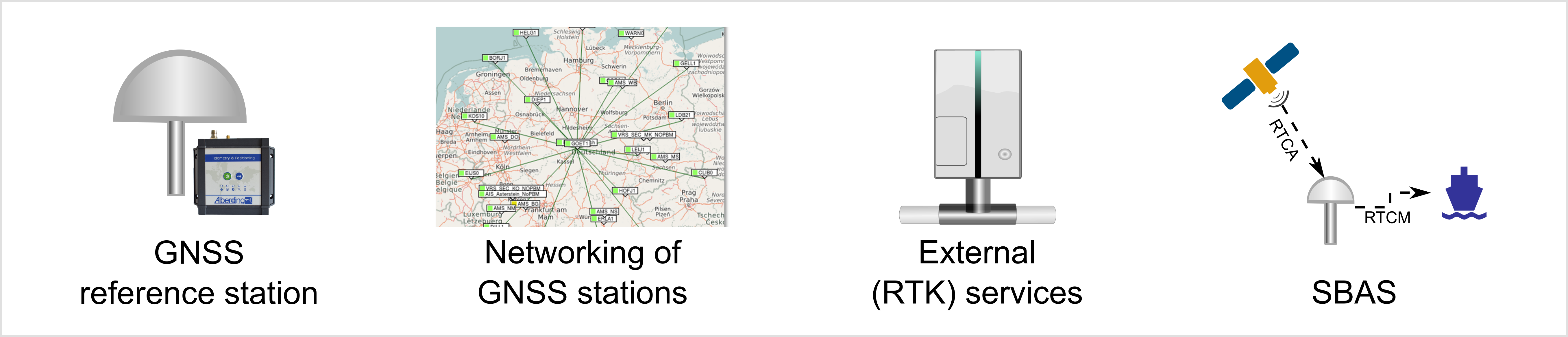
Use of GNSS correction data from different sources (reference station, network, SBAS).
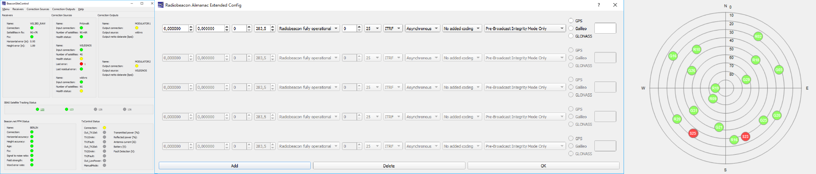
Integrity check before sending the correction data (Pre-Broadcast monitoring - PBM) and combination of GNSS corrections and waterway information.
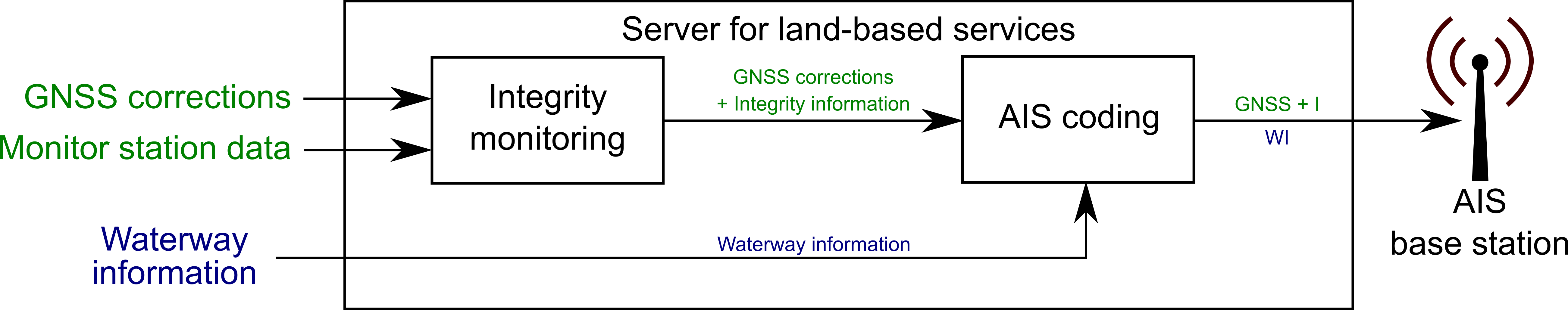
Support of multiple transmissions (Beacon, AIS, Ntrip).

Backup system at the Beacon transmitter.
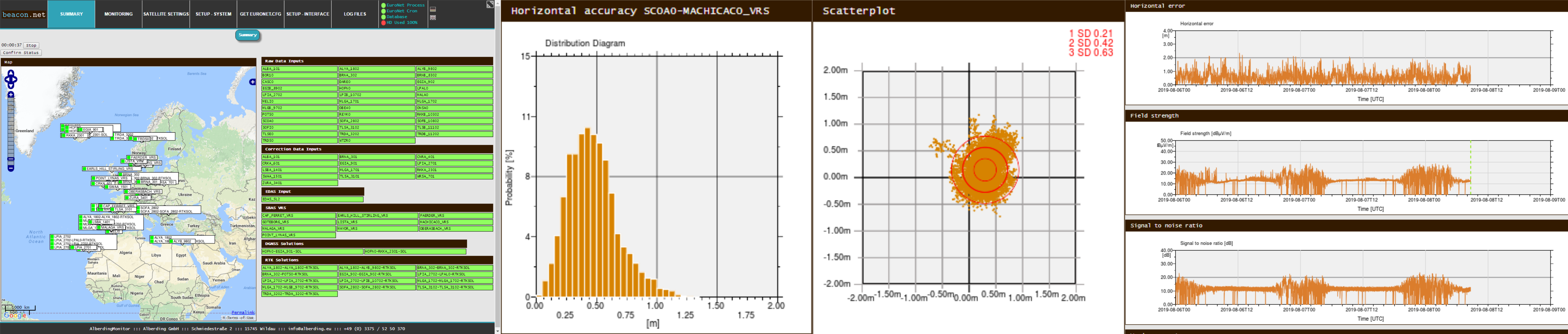
Monitoring of data transmission and positioning accuracy via remote monitoring stations (Far Field Monitoring).
GNSS hardware for the operation of reference and monitoring stations.