About us


")
")
")


Surveying
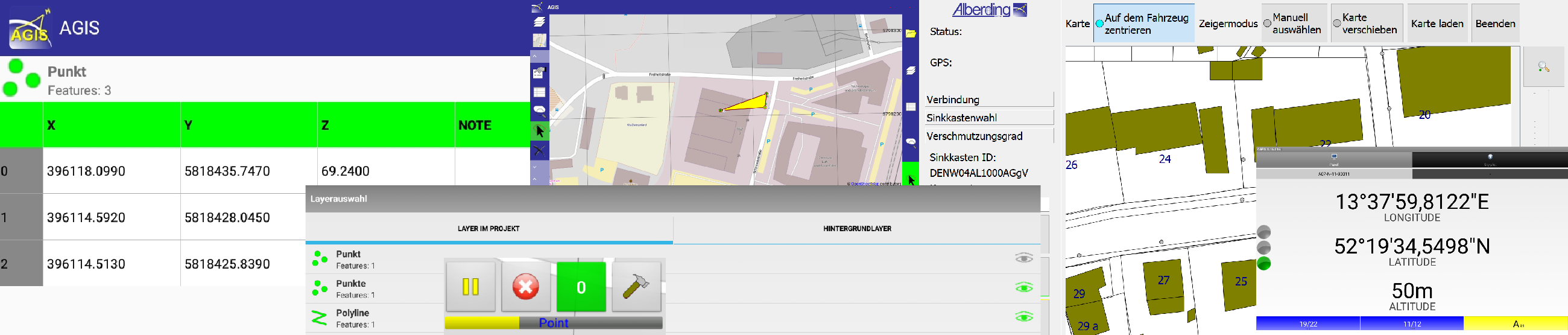
The Alberding A08 and A10-RTK sensors are used with a compatible field software to measure and stake out points, lines and polygons with millimetre accuracy. The target groups of the systems are primarily users who require an intuitive and affordable RTK system.

Surveying applications are performed in the field acquisition software on a Tablet PC. With the AGIS software, Alberding GmbH offers a field software that is easy to use and adaptable to the respective tasks. Since the positions are transferred in the MNEA standard format, the systems can also be used with third-party software (e.g. QField).
Due to a limited mobile coverage and higher accuracy requirements, GNSS carrier phase raw data must be recorded for post-processing purposes. The A08-RTK and A10-RTK sensors can store this measurement data internally and transfer it to a computer. The extended version of the Alberding Configurator is used to set up the measurement (point number, antenna height, measurement time).