 About us


Machine positioning Software (MaPoS)
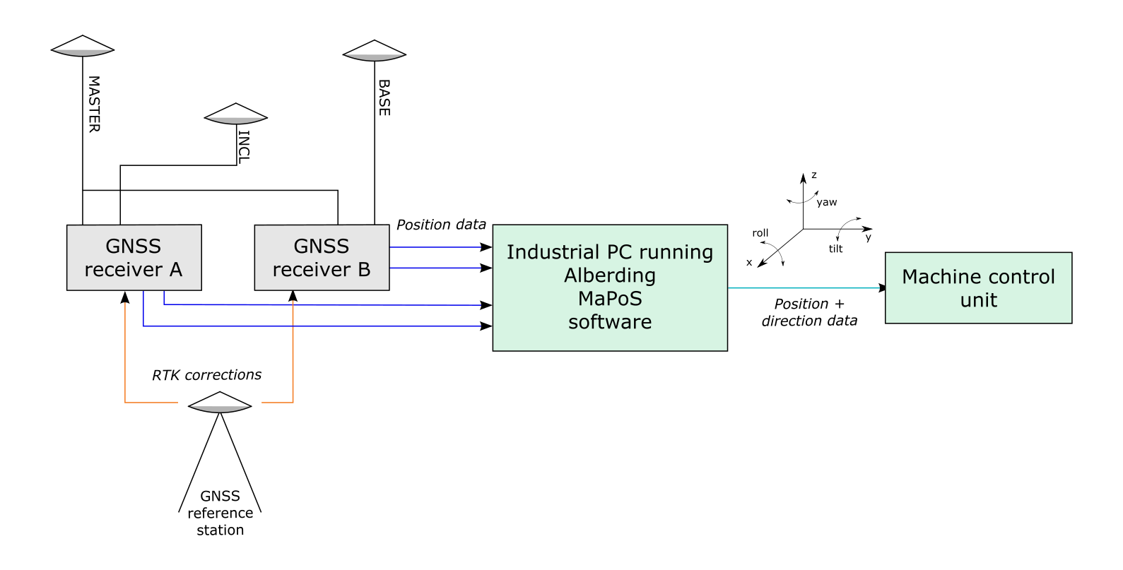
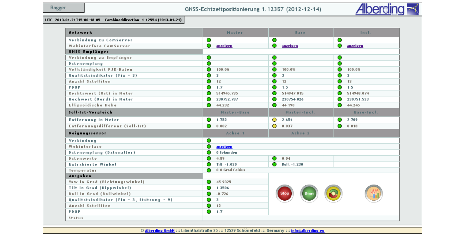
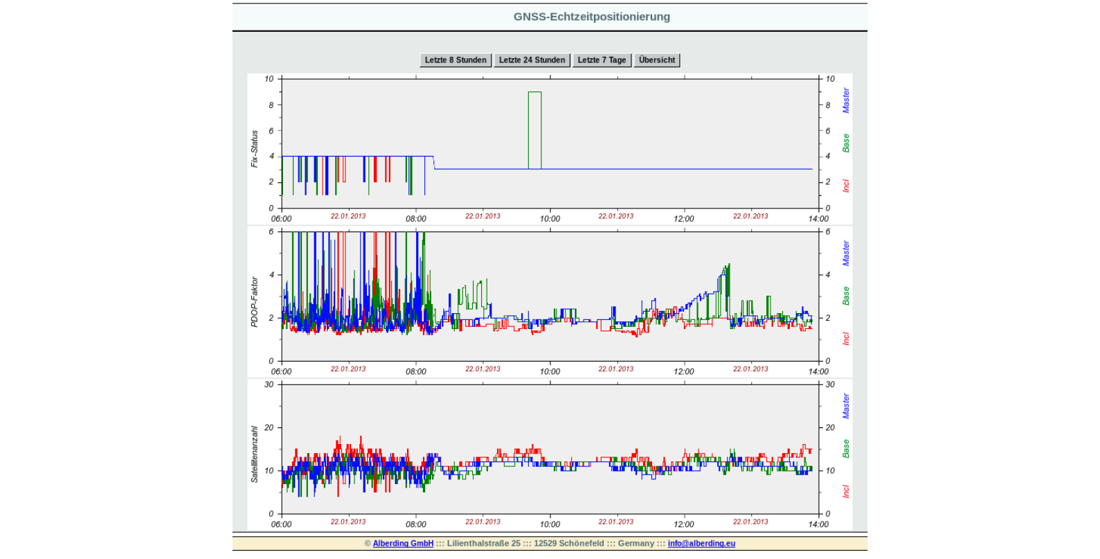
The Alberding MaPoS software is designed to accurately determine the position and direction (pitch, roll, yaw) of large surface mining equipment. The machine positioning is based on the measurement data from precise GNSS RTK sensors and inclinometers. Customized formats are output to the machine's control unit.
The MaPoS software has been successfully used for more than 10 years to determine the bucket wheel center of open pit excavators using three GNSS RTK sensors or one RTK and one RTK/Heading sensor. The combination of an RTK/Heading sensor with a two-axis inclination sensor is also supported.