 About us


Inland waterways
Alberding GmbH offers hardware and software solutions for operators of information and positioning services in the field of inland waterways and ports. Mobile GNSS sensors are available for the determination of the ship's position and the monitoring of structures and navigation signs.
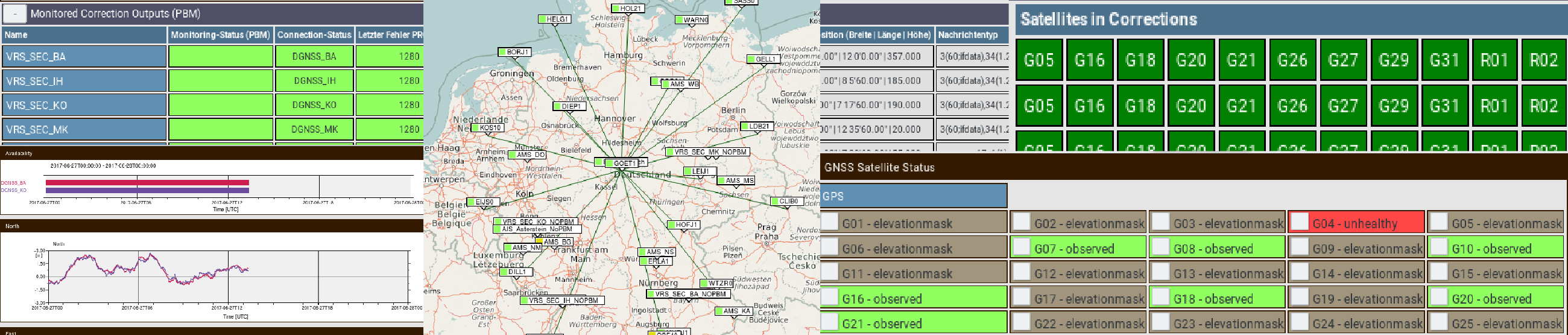
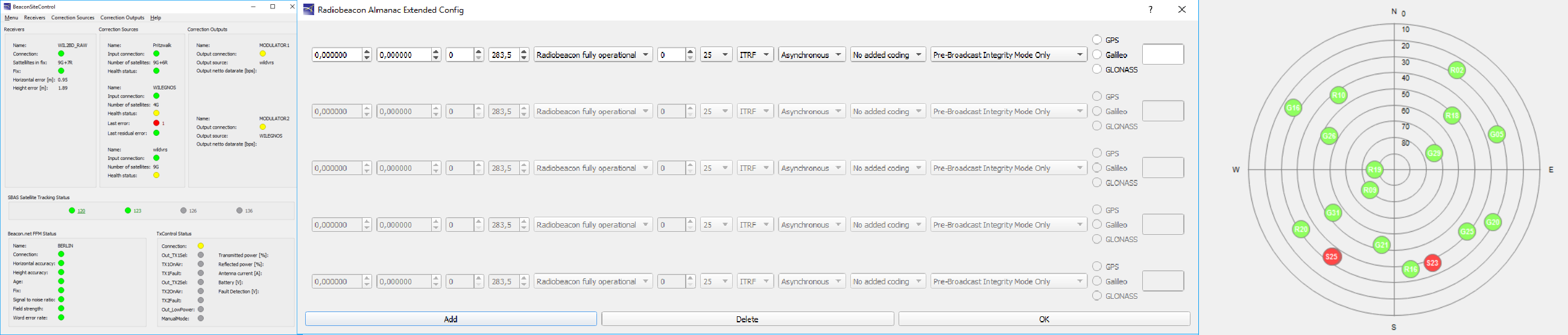
Alberding Beacon.net software is used by Aids-to-Navigation (AtoN) service providers to supply integrity-tested GNSS correction data. The correction data come from own reference stations, reference station networks or SBAS services (EGNOS). Transmissions via radio beacon, AIS, radio and mobile Internet are supported.
A central generation of correction data requires reliable data connections to the sender locations. As a backup solution at the transmitter, a GNSS receiver with SBAS and raw data ports and the BeaconSiteControl software are provided. If the data connection is interrupted, the system automatically switches to the backup solution.
For three-dimensional determination of ship position and pre-alignment, we offer the Trimble BX992 Heading System with integrated INS and the Alberding A10 Sensor in several configurations. The A08-MON is available for the permanent monitoring of structures and the positioning of traffic signs.

For the permanent monitoring of the broadcasts, remote monitoring stations (Far Field Monitoring) are operated by the AtoN service providers in the coverage area of the transmitters. In addition to positioning accuracy, the data age of the correction data and the parameters field strength, word error rate and signal-to-noise ratio for signal reception are monitored. These data are integrated into the Far Field Monitoring module of the Beacon.Net software.

Selected customers from the navigation sector:


