About us


")
")
")


GNSS monitoring
Alberding GmbH uses GNSS sensors for the following monitoring applications:
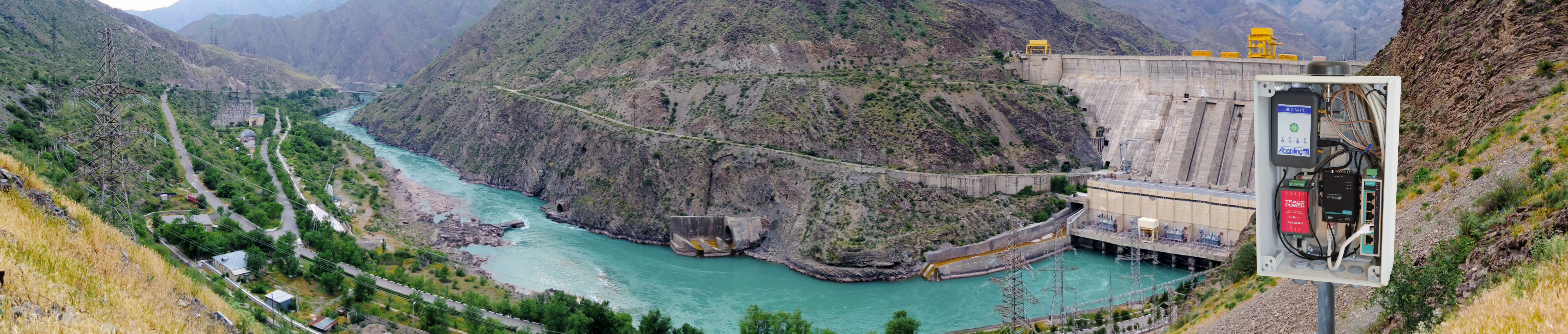
Deformation monitoring is used to detect movements of civilian structures or in the earth's surface. Three-dimensional displacements of up to a few millimetres can be detected by continuously determining the GNSS antenna position. Due to the advantages of the satellite-based measurement method, GNSS sensors make a valuable contribution to geo-monitoring, either used alone or in combination with other sensors.
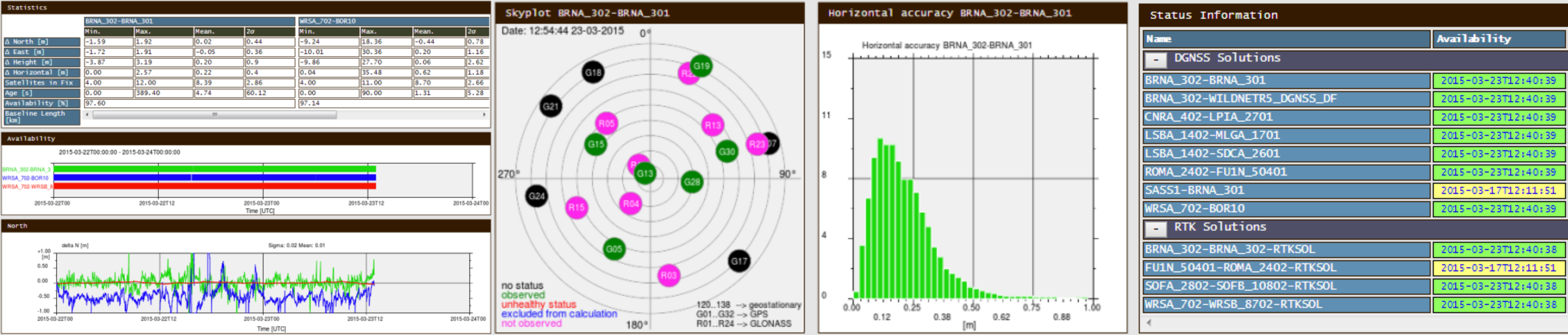
GNSS services are used to provide the active official spatial reference in surveying (e.g. SAPOS) and precision agriculture. Real-time corrections are generated by software packages using measurement data from permanent GNSS reference stations. Dedicated monitoring stations and quality control applications supervise the GNSS service, continuously monitoring the availability and quality of the corrections and the achievable positioning accuracy. For these tasks, Alberding GmbH offers the A10-RTK sensor and the Alberding-QC software.
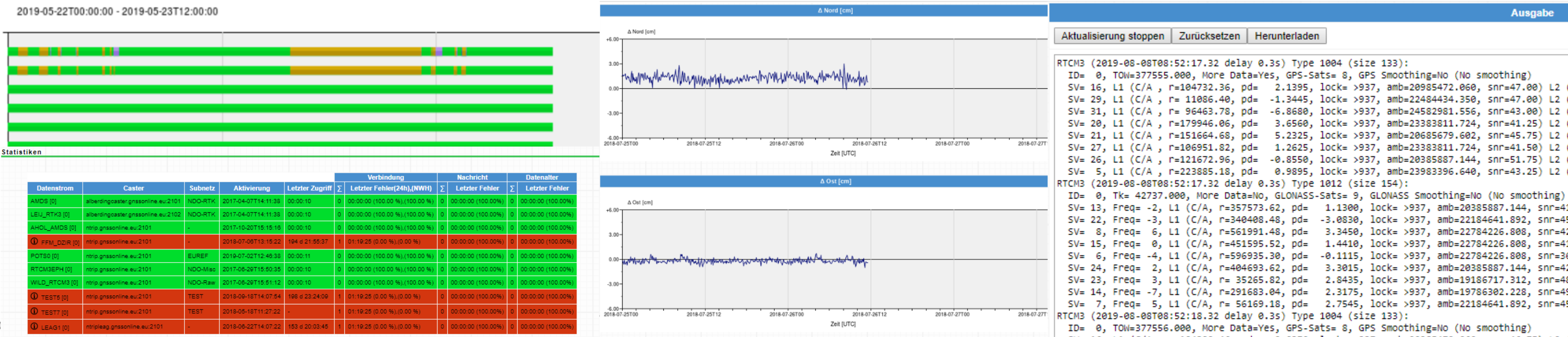
For safety-critical applications, a preliminary check of the effect of DGNSS or RTK corrections is required. During pre-broadcast monitoring, the GNSS correction data is applied to the raw data streams of monitoring stations and checked before transmission. The resulting integrity information is attached to the correction streams and transmitted to the users.

GNSS positioning is used as a basis for toll systems and safety-critical processes. The Alberding GNSS Status Software can be used by customers to check the GNSS system performance.
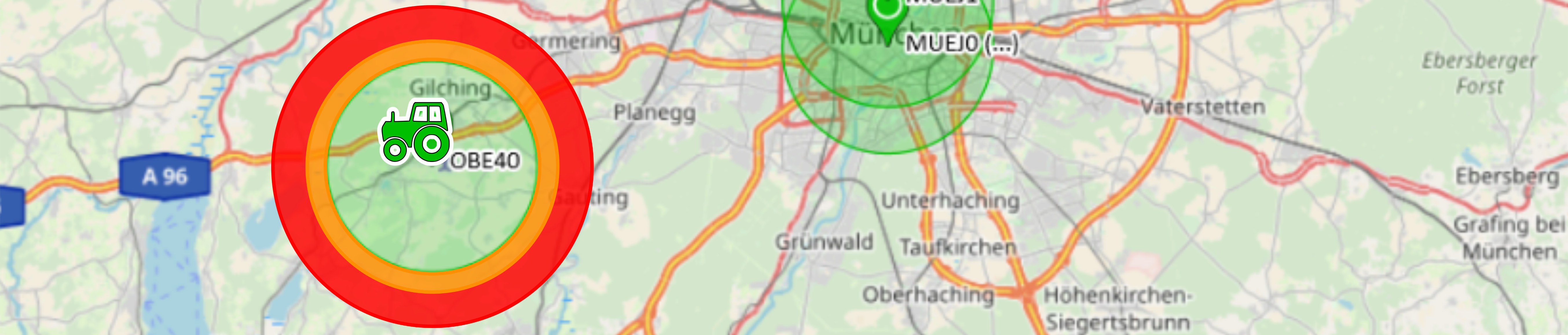
The Alberding telemetry and positioning systems are used autonomously to determine the position of moving platforms and other objects (e.g. traffic signs). If these objects move outside specified zones, the sensors can notify a predefined group of people via text message or e-mail.
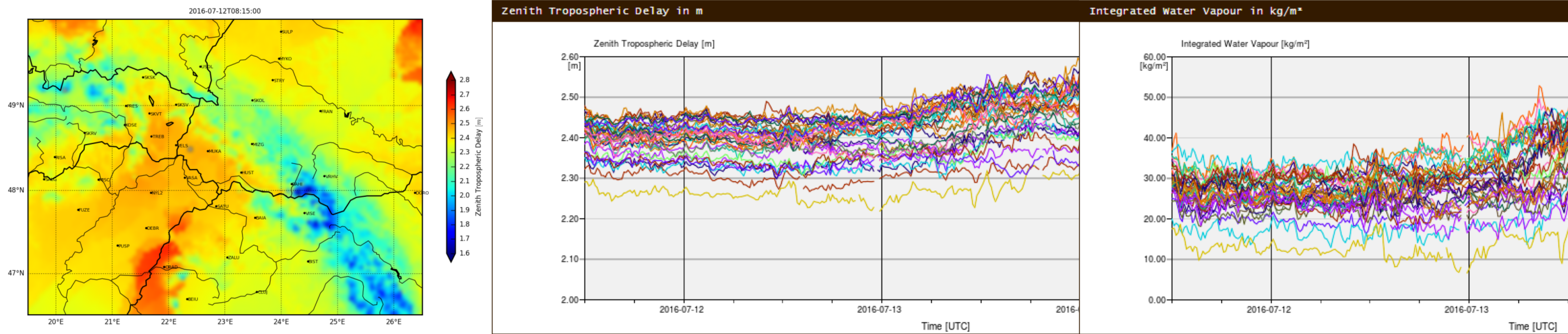
Determination of humidity content in the troposphere.