 About us


Machine positioning Software (MaPoS)
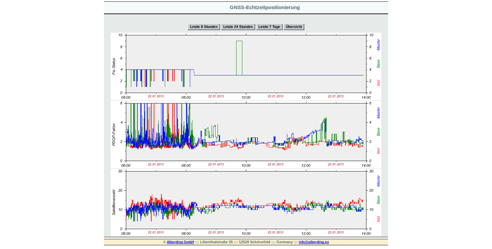
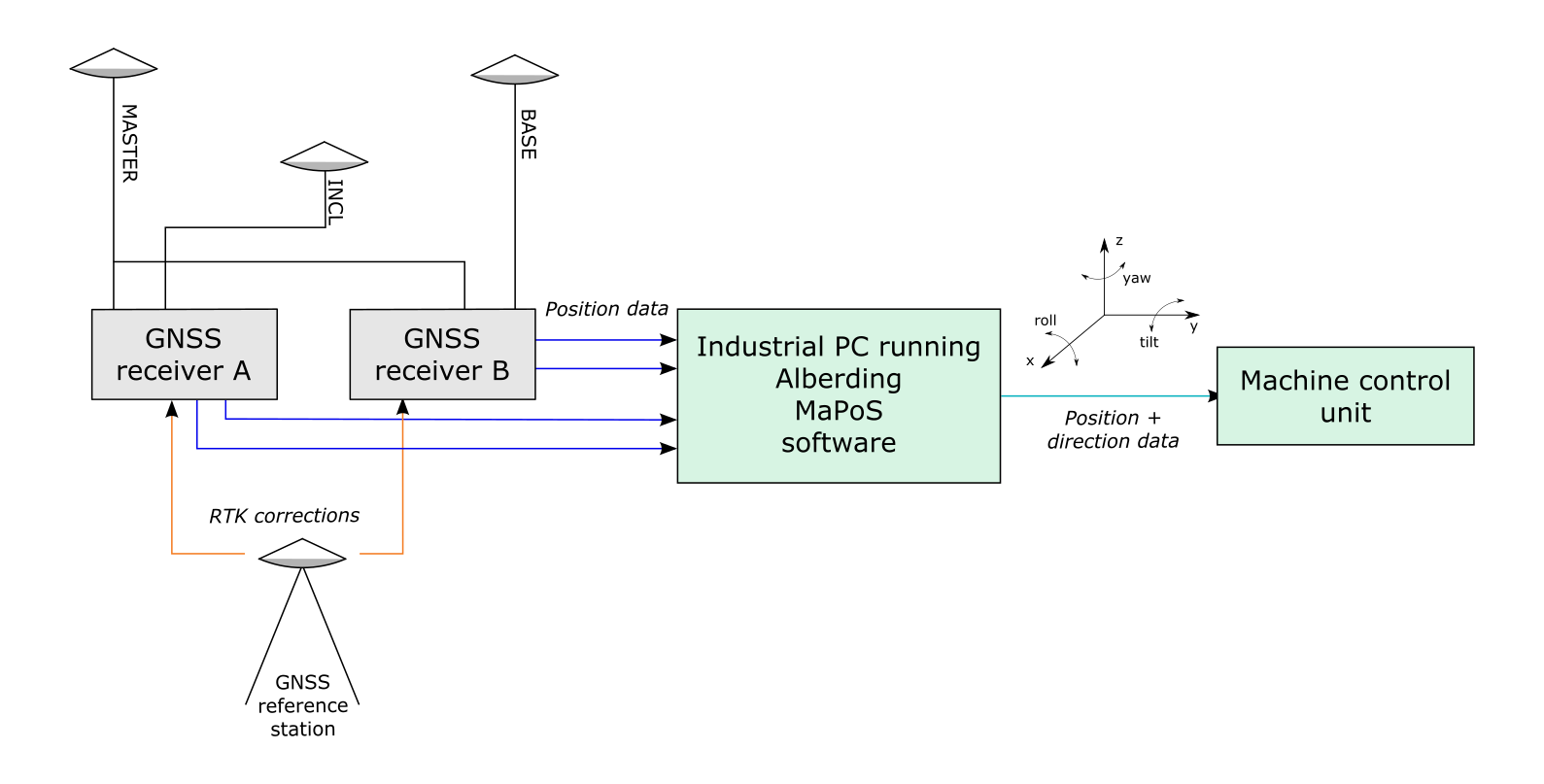
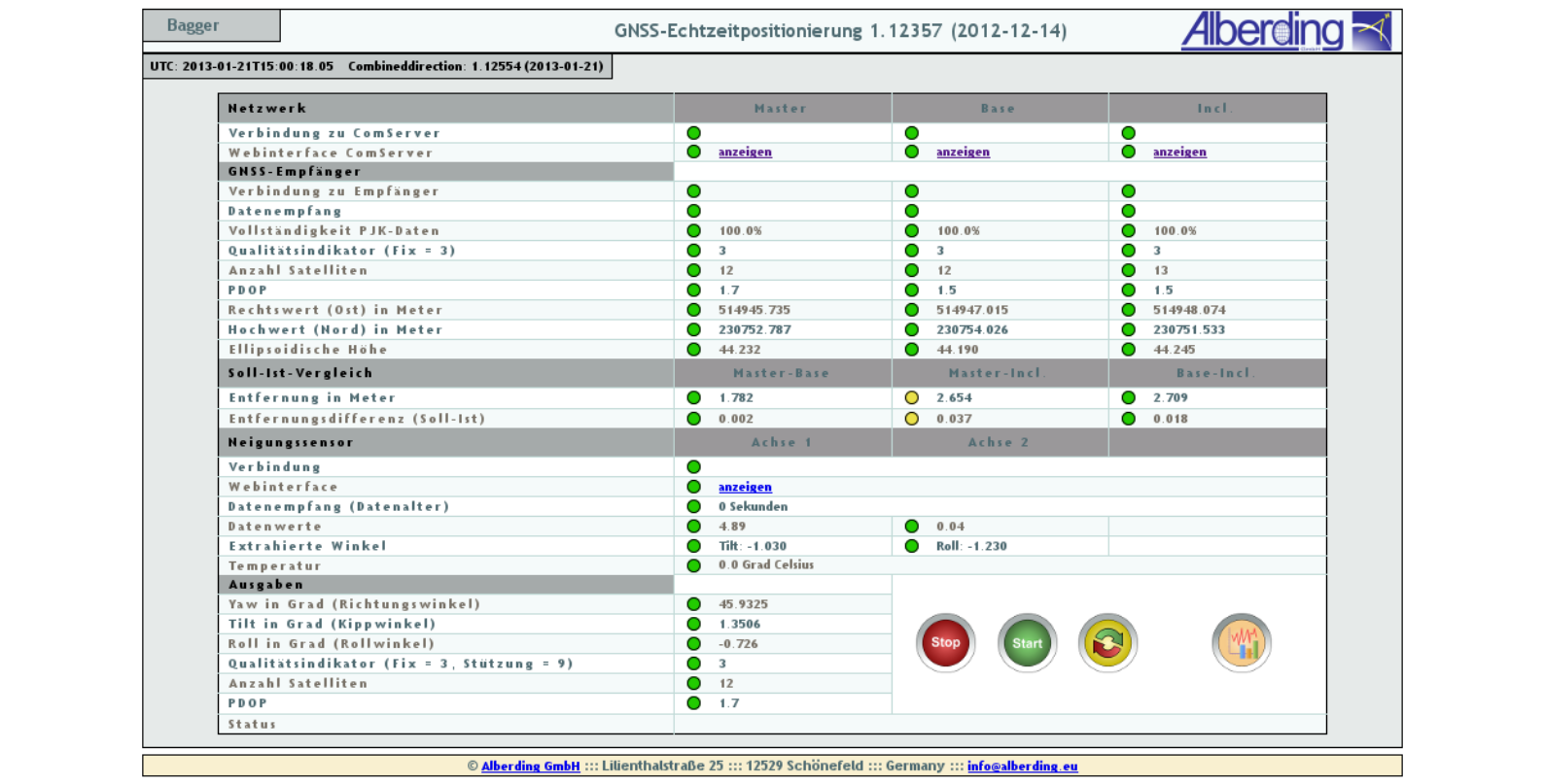
MaPoS has been successfully used for more than 10 years in the combination of GNSS-RTK and inclination sensors for position and direction determination on large open pit mining equipment (bucket wheel excavators, spreaders) and the positioning of track-laying machines.
MaPoS can be easily adapted for the positioning of other moving platforms (ships, tractors, construction machinery).