 About us


Alberding A10-RTK
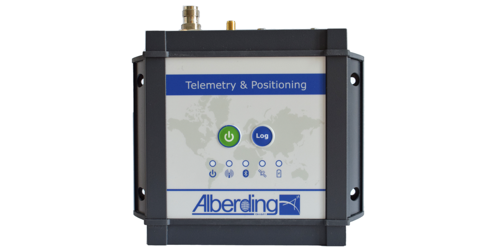
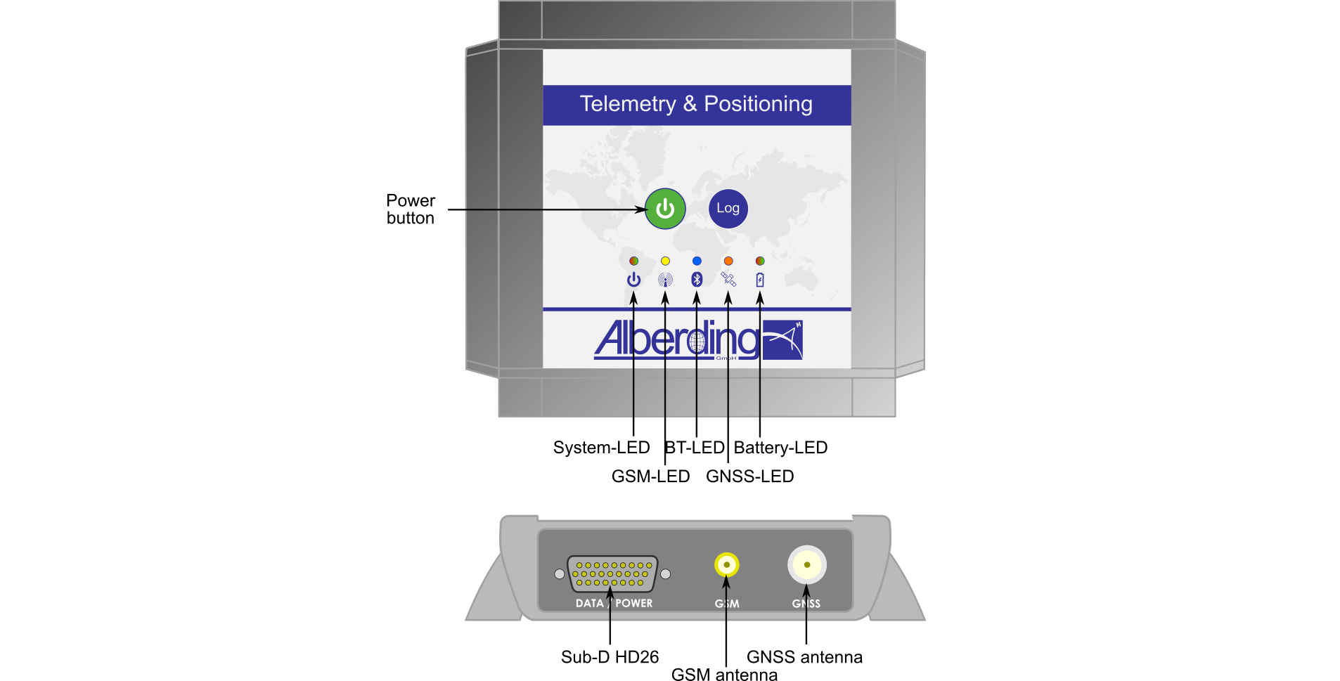
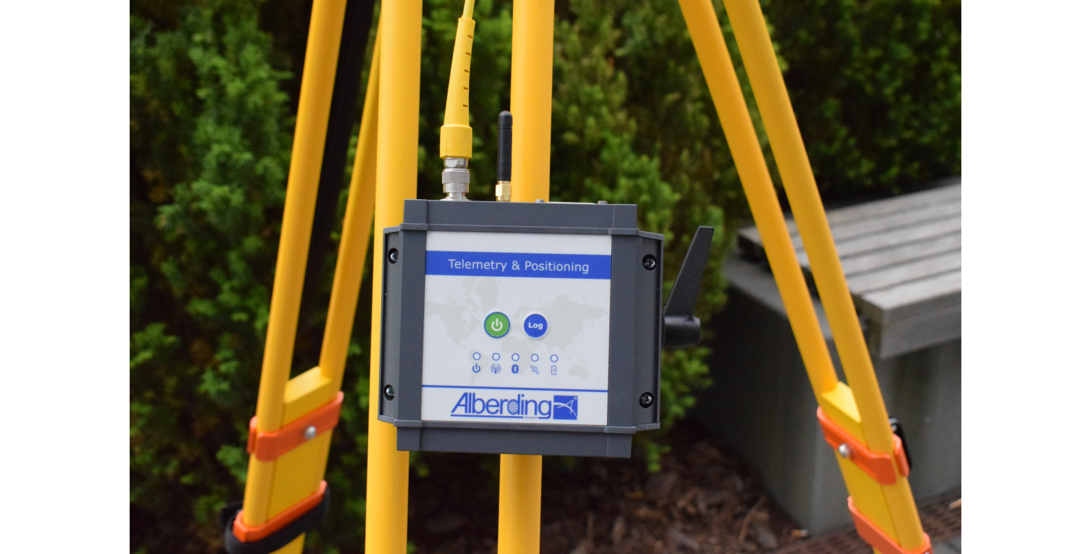
One system - multiple applications
The integration of an embedded PC in the A10-RTK sensor is the key to flexible system customisation for diverse digitisation and automation tasks. While the integrated microprocessor controls the data transfer in the A10-RTK sensor, the software can perform more extensive calculations on the embedded PC. Currently, both software solutions from Alberding GmbH (e.g. EuroRef and EuroNet) and third-party software (e.g. BNC from the Federal Agency for Cartography and Geodesy and SSR2OSR converter from Geo ++ GmbH) are supported.
Show more
Show less
Examples of software applications on the integrated embedded PC:
- Autonomous GNSS reference and monitoring station
- RTK correction data provision
- Monitoring of RTK services in the field
- Enhanced GNSS rover functionality
- Support of two different IP address domains, one for RTK correction data and another for GNSS positioning data
- Switching between two correction data sources (e.g. mobile Internet and radio data transmission in the 70 cm band)
- Integration of GNSS algorithms
- GNSS data conversion (SSR→OSR, DataConv)
- GNSS positioning algorithms (BNC, RTKLib)
- Monitoring objects, buildings and embankments
- Geomonitoring in engineering technology
- Geofencing, machine monitoring
- Sensor fusion
- Combined data acquisition from GNSS and external sensors (EuroNet)
- Combined analysis of GNSS and external sensor data
- Project data transmission
- Transmission of engineering project data (digital terrain model, station coordinates)
- Transfer of agricultural management data (site-specific fertilisation)
- Telemetry module with RTK
- Data retrieval and transmission from agricultural and construction machines
- Combination of telemetry and RTK