About us


GNSS Data Management Software (Ntrip)
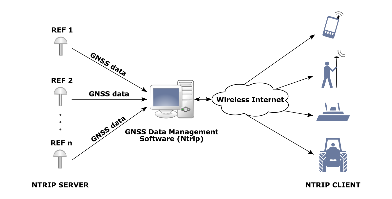
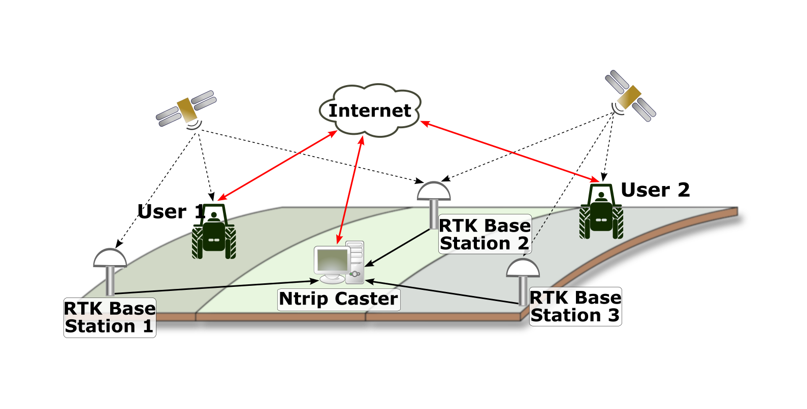
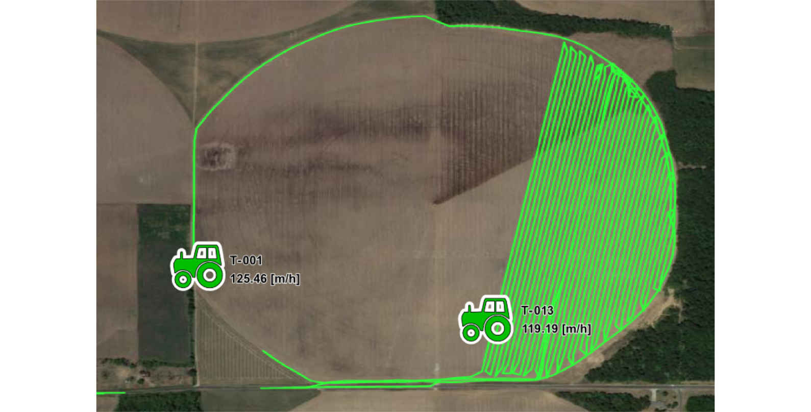
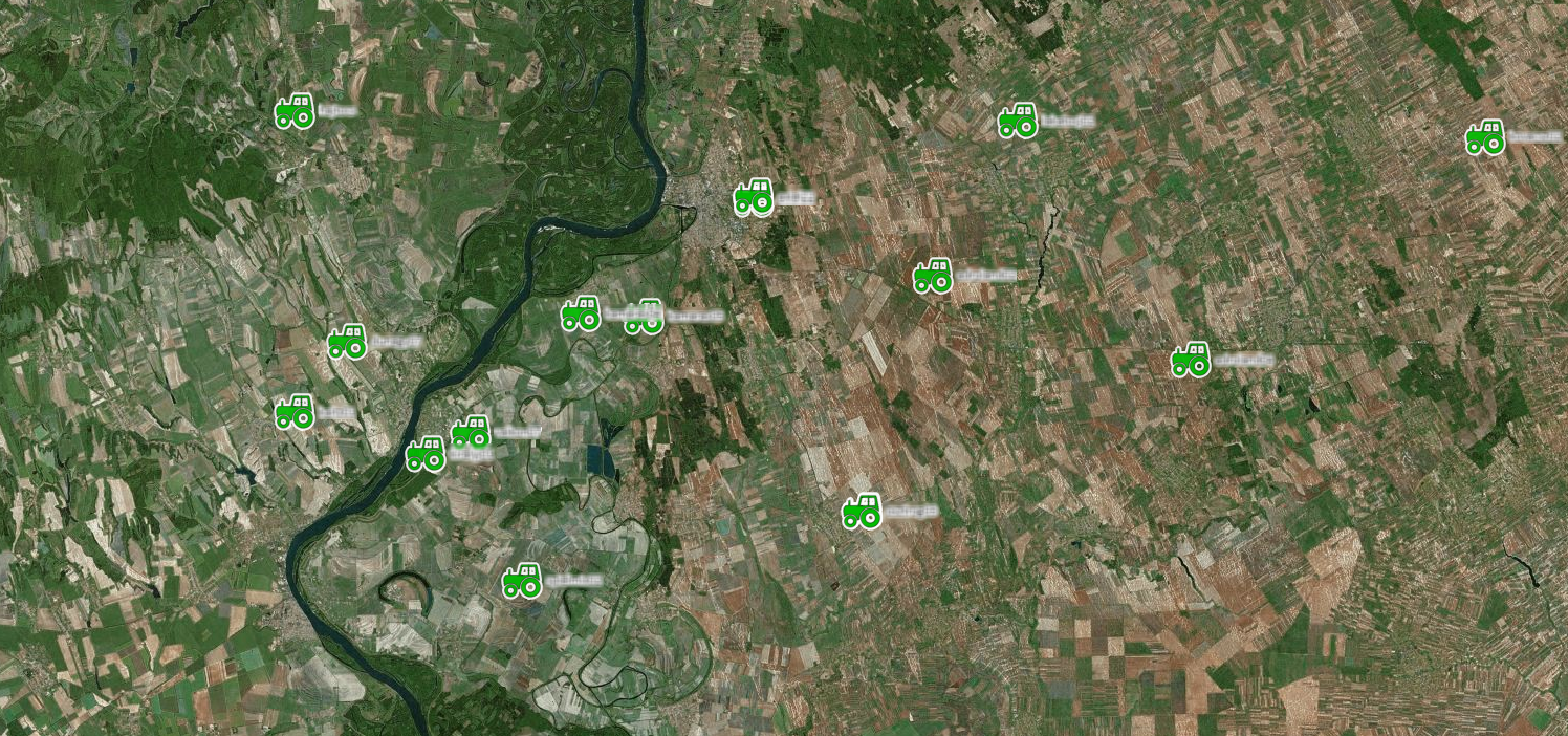
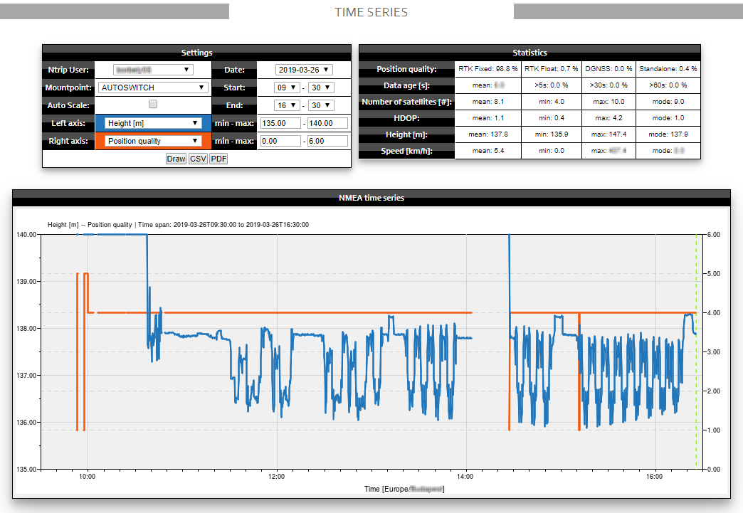
The GNSS Data Management Software (Ntrip) provides advanced user tracking and fleet management functionalities. While receiving RTK corrections from the Ntrip caster, user receivers send their precise position (along with other useful information) back to the server at regular intervals. This input data is used to monitor the position and RTK fixing status of the connected clients. A real-time status table shows all connected users with their current position quality, number of tracked satellites, correction data age, IP address, Internet service provider, etc. information. The Alberding GNSS Data Management Software (Ntrip) map display shows user positions in real time with colour coded icons indicating position quality. Historic user positions and performance data can be analysed on KML tracks and time series graphs, which can be archived for reporting.
All these details can be used very effectively when troubleshooting potential user-side problems (for example mobile Internet connectivity issues or satellite tracking problems).
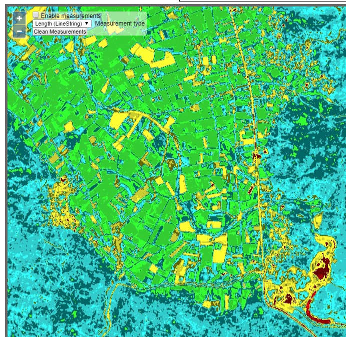
On the map display, GNSS Data Management (Ntrip) operators can choose from several base layers and overlays. As an optional feature, custom-specific map layers can be displayed from WMS/TMS/WMTS map services. It is even possible to display various Sentinel satellite imageries as background layers (e.g. vegetation index, moisture index, infrared vegetation, etc.).
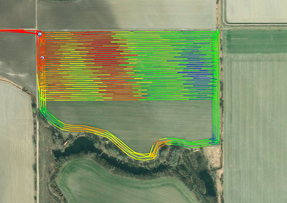
Field boundaries can be uploaded to the Alberding GNSS Data Management Software (Ntrip) web interface in KML, XML or Shapefile formats, which then can be displayed on the map as overlays together with attribute information such as crop type or land parcel area.
User-specific connection information is summarised in a tabular form that can be used for reporting and billing purposes.